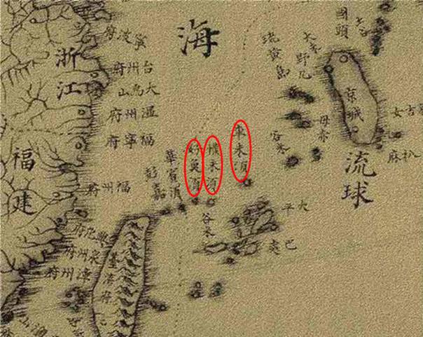
Great Universal Geographic Map (Kun Yu Quan Tu)
Michael Benoist, a French Jesuit, was commissioned by the Qing court to create “Great Universal Geographic Map (Kun Yu Quan Tu).” On the basis of “Geographic Map of The Empire (Huang Yu Quan Tu)” and upgraded charting methods, the new map was finished in 1767 (the 9th year of the reign of Emperor Qianlong of the Qing Dynasty) and labeled Diaoyu Dao in China’s coastal waters using words from the Minnan dialect (Ban Lam Gu). “Great Universal Geographic Map” was authorized by Emperor Qianlong, which indicated that Diaoyu Dao had been included in the territory of the Qing Empire.
