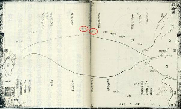
Navigation Map (Zhen Lu Tu)
This map was part of the Annals of Ryukyu (Liu Qiu Guo Zhi Lue) by Zhou Huang, a deputy imperial envoy in 1756 (the 21st year of the reign of Emperor Qianlong of the Qing Dynasty). It shows that Diaoyu Dao and its affiliated islands are on the sailing route from China to Ryukyu.
